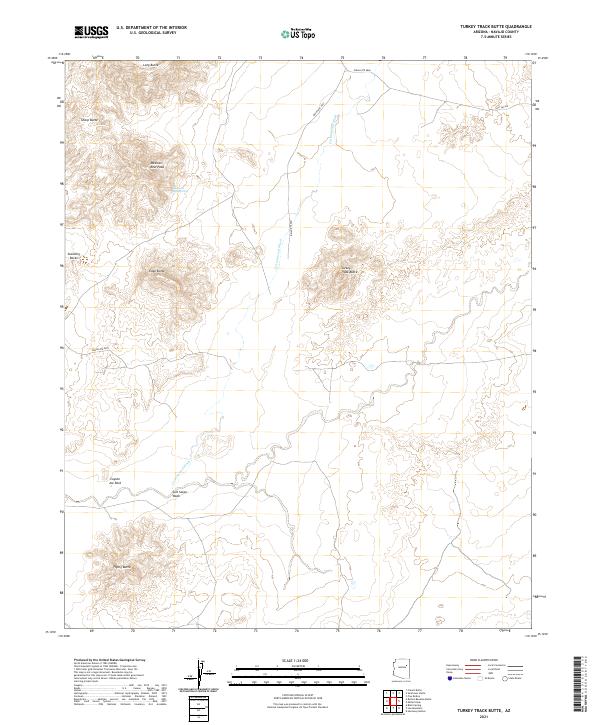
2021 Map of Turkey Track Butte
USGS Topo · Published 2021About this map
Turkey Track Butte serves as a central landmark in this high-desert landscape of Navajo County, where a network of seasonal watercourses and prominent geological features defines the terrain. The presence of Mexican Rest Spring and Mexican Rest Peak suggests historical use of this area for relief in an otherwise arid environment. Navigation across the northern plateau is facilitated by routes like Indian Rte 9861, which follows the drainage of Cottonwood Wash.
Find a feature on this map
19 named features on this map. Tap any name to fly to it.
Don’t see what you’re looking for? This feature index may not catch every label — zoom into the map to look around manually.
Map Details
Editions of this 2021 Turkey Track Butte Map
This is the sole edition of this map. No revisions or reprints were ever made.
Other maps of this area

1883 · Tusayan
USGS Topo · 1:250,000

1886 · Tusayan
USGS Topo · 1:250,000

1947 · Flagstaff
USGS Topo · 1:250,000

1954 · Flagstaff
USGS Topo · 1:250,000

1958 · Flagstaff
USGS Topo · 1:250,000

1960 · Flagstaff
USGS Topo · 1:250,000

1962 · Flagstaff
USGS Topo · 1:250,000
1967 · French Butte
USGS Topo · 1:24,000
1972 · Turkey Track Butte
USGS Topo · 1:24,000
1972 · Mitten Peak
USGS Topo · 1:24,000