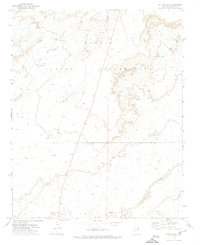
1972 Map of Mitten Peak
USGS Topo · Published 1974About this map
The Navajo Indian Reservation landscape in the early 1970s is defined by its intermittent water sources and the remnants of previous occupation. Traces of historical activity are scattered across the terrain, including multiple sites simply labeled Ruins and several Corral structures, suggesting a long history of seasonal habitation and livestock management. This high-desert environment relies on features like Spencer Well and the mineral-laden Salt Seeps for survival. Drainage patterns are dominated by the Salt Seeps Wash and the winding Leroux Wash, which carve through the land and dictate the placement of local infrastructure. A primitive network of transportation is visible through the Jeep Trail that crosses the territory, providing a link between these isolated landmarks and the vast desert floor.
Find a feature on this map
10 named features on this map. Tap any name to fly to it.
Don’t see what you’re looking for? This feature index may not catch every label — zoom into the map to look around manually.
Map Details
Editions of this 1972 Mitten Peak Map
This is the sole edition of this map. No revisions or reprints were ever made.
Other maps of this area

1883 · Tusayan
USGS Topo · 1:250,000

1886 · Tusayan
USGS Topo · 1:250,000

1886 · Fort Defiance
USGS Topo · 1:250,000

1892 · Fort Defiance
USGS Topo · 1:250,000

1947 · Flagstaff
USGS Topo · 1:250,000

1954 · Flagstaff
USGS Topo · 1:250,000

1954 · Gallup
USGS Topo · 1:250,000

1958 · Gallup
USGS Topo · 1:250,000

1958 · Flagstaff
USGS Topo · 1:250,000

1959 · Gallup
USGS Topo · 1:250,000