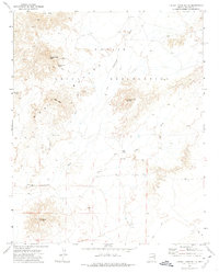
1972 Map of Turkey Track Butte
USGS Topo · Published 1974About this map
The Hopi Indian Reservation and Navajo Indian Reservation border one another in this high-desert landscape, where land use is marked by scattered ruins, corrals, and remote water sources. In the early 1970s, the terrain was traversed primarily by a network of Jeep Trails, linking isolated landmarks like Mexican Rest Spring and Mexican Rest Peak. The drainage of Cottonwood Wash dictates the movement of water through this arid region, supported by man-made improvements such as the Salt Water Tank and Well 5305. Distinctive geological features like Turkey Track Butte, Edge Butte, and Standing Rocks serve as the primary navigational anchors in a territory otherwise defined by wide washes and open range.
Find a feature on this map
20 named features on this map. Tap any name to fly to it.
Don’t see what you’re looking for? This feature index may not catch every label — zoom into the map to look around manually.
Map Details
Editions of this 1972 Turkey Track Butte Map
This is the sole edition of this map. No revisions or reprints were ever made.
Other maps of this area

1883 · Tusayan
USGS Topo · 1:250,000

1886 · Tusayan
USGS Topo · 1:250,000

1947 · Flagstaff
USGS Topo · 1:250,000

1954 · Flagstaff
USGS Topo · 1:250,000

1958 · Flagstaff
USGS Topo · 1:250,000

1960 · Flagstaff
USGS Topo · 1:250,000

1962 · Flagstaff
USGS Topo · 1:250,000
1967 · French Butte
USGS Topo · 1:24,000
1972 · Mitten Peak
USGS Topo · 1:24,000
1972 · Hennessy Buttes
USGS Topo · 1:24,000