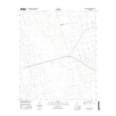
2016 Map of Turnbaugh Corner
USGS Topo · Published 2016About this map
Turnbaugh Corner sits at the intersection of Fm 181 and Scharbauer St, serving as a central point in this expansive West Texas landscape. The terrain is defined by a sparse network of ranch roads and sections, with Ranch Rd 2019 and S Fm 2019 cutting through the southern half of the quadrangle. A notable geographic feature in the western portion of the map is Cheyenne Lake, one of several depressions that dot the high plains environment. The map details a systematic grid of local roads, including Station Rd and its northern extension, N Station Rd, which highlight the organized division of land for agricultural or industrial use characteristic of Ector County. This survey captures the region's functional layout, where primary corridors like W Scharbauer St provide the necessary infrastructure for traversing the open country.
Find a feature on this map
18 named features on this map. Tap any name to fly to it.
Don’t see what you’re looking for? This feature index may not catch every label — zoom into the map to look around manually.
Map Details
Editions of this 2016 Turnbaugh Corner Map
This is the sole edition of this map. No revisions or reprints were ever made.
Other maps of this area

1954 · Hobbs
USGS Topo · 1:250,000

1954 · Pecos
USGS Topo · 1:250,000

1957 · Pecos
USGS Topo · 1:250,000

1958 · Hobbs
USGS Topo · 1:250,000

1964 · Turnbaugh Corner
USGS Topo · 1:24,000

1964 · Douro
USGS Topo · 1:24,000

1964 · Red Lakes
USGS Topo · 1:24,000

1965 · Goldsmith
USGS Topo · 1:24,000

1967 · North Cowden
USGS Topo · 1:24,000

1968 · Coyote Corner
USGS Topo · 1:24,000