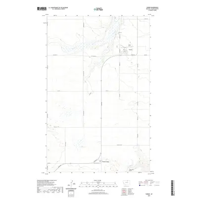
2020 Map of Turner
USGS Topo · Published 2020About this map
Turner serves as the focal point for this section of northern Blaine County, situated near the headwaters of Buckley Cr. The community's local geography is defined by a grid of rural routes including Hogeland Rd, Loring Rd, and the central W Railroad Ave, which reflects the area's agricultural and transportation history. To the south, Turner Colony marks a distinct communal settlement, while Turner Cem and Turner Airport provide evidence of the town's established infrastructure. The landscape is characterized by intermittent drainages and geographic depressions such as Little Jewel Coulée in the southeast corner. This modern survey, compiled from data ranging from 1899 to 2019, tracks the evolution of road networks and land use, from the expansive Phillips Rd to smaller township boundaries like t36n r25e.
Find a feature on this map
32 named features on this map. Tap any name to fly to it.
Don’t see what you’re looking for? This feature index may not catch every label — zoom into the map to look around manually.
Map Details
Editions of this 2020 Turner Map
This is the sole edition of this map. No revisions or reprints were ever made.
Other maps of this area

1903 · Wayne Creek
USGS Topo · 1:62,500

1905 · Wayne Creek
USGS Topo · 1:62,500

1913 · Cherry Ridge
USGS Topo · 1:125,000

1920 · Avery
USGS Topo · 1:125,000

1953 · Havre
USGS Topo · 1:250,000

1957 · Havre
USGS Topo · 1:250,000

1958 · Havre
USGS Topo · 1:250,000

1984 · Hogeland SE
USGS Topo · 1:24,000

1984 · Turner
USGS Topo · 1:24,000

1984 · Turner NE
USGS Topo · 1:24,000