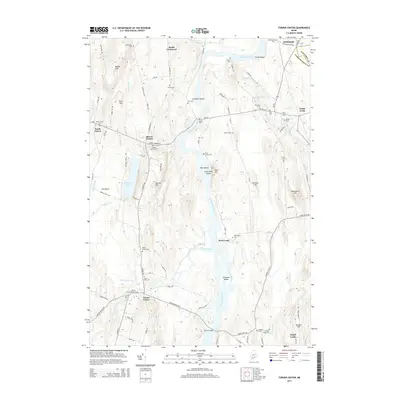
2014 Map of Turner Center
USGS Topo · Published 2014About this map
The Androscoggin River carves a central path through this Maine landscape, serving as the historical dividing line between Androscoggin Co and Kennebec Co. Along its banks and tributaries, like the Nezinscot River and Dead River, numerous small agricultural settlements and crossroads communities define the region's character. Significant for genealogical research, the map identifies over a dozen burial grounds, including the Maple Grove Cem, Keens Mills Cem, and the family-named Francis Cem. The river's influence on local geography is evident in the many named islands and landforms, such as Lovewell Island, Ram Island, and Griswold Island. From the hilltop elevations of Torry Hill and Merrill Hill to the river crossing at Turner Bridge, this survey documents the persistent rural settlement patterns of Turner Center and West Leeds in the early 21st century.
Find a feature on this map
101 named features on this map. Tap any name to fly to it.
Don’t see what you’re looking for? This feature index may not catch every label — zoom into the map to look around manually.
Map Details
Editions of this 2014 Turner Center Map
This is the sole edition of this map. No revisions or reprints were ever made.
Other maps of this area

1908 · Poland
USGS Topo · 1:62,500

1908 · Lewiston
USGS Topo · 1:62,500

1910 · Livermore
USGS Topo · 1:62,500

1911 · Buckfield
USGS Topo · 1:62,500

1912 · Livermore
USGS Topo · 1:62,500

1913 · Buckfield
USGS Topo · 1:62,500

1940 · Poland
USGS Topo · 1:62,500

1941 · Livermore
USGS Topo · 1:62,500

1942 · Lewiston
USGS Topo · 1:62,500

1942 · Buckfield
USGS Topo · 1:62,500