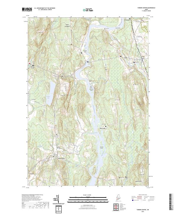
2024 Map of Turner Center
USGS Topo · Published 2024About this map
Androscoggin River serves as the central artery of this region, winding past a sequence of river islands including Lovewell Island and Griswold Island. The landscape is defined by the confluence of the river with the Nezinscot River near Turner Center, a geography that historically dictated the placement of early crossings and milling operations. Numerous family and community cemeteries, such as Keens Mills Cem and Maple Grove Cem, are distributed along the ridges and valley floor, offering significant data points for genealogical research. The road network, including the old Merrills Mill Rd, traces the early development of The Plains and South Livermore, where the transition from riverfront to upland hills like Torry Hill and Monument Hill shaped the local agricultural and timber economy.
Find a feature on this map
96 named features on this map. Tap any name to fly to it.
Don’t see what you’re looking for? This feature index may not catch every label — zoom into the map to look around manually.
Map Details
Editions of this 2024 Turner Center Map
This is the sole edition of this map. No revisions or reprints were ever made.
Other maps of this area

1908 · Poland
USGS Topo · 1:62,500

1908 · Lewiston
USGS Topo · 1:62,500

1910 · Livermore
USGS Topo · 1:62,500

1911 · Buckfield
USGS Topo · 1:62,500

1912 · Livermore
USGS Topo · 1:62,500

1913 · Buckfield
USGS Topo · 1:62,500

1940 · Poland
USGS Topo · 1:62,500

1941 · Livermore
USGS Topo · 1:62,500

1942 · Lewiston
USGS Topo · 1:62,500

1942 · Buckfield
USGS Topo · 1:62,500