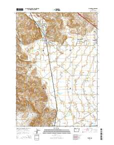
2014 Map of Turner
USGS Topo · Published 2014About this map
Turner and Aumsville anchor this rural landscape in the southern Willamette Valley, where a network of irrigation and drainage canals like the Perrin Lateral and Main Canal support the region's agricultural character. The terrain is marked by the rising Salem Hills and the distinct Parrish Gap to the south, while the North Santiam River flows along the southern boundary. This map is particularly significant for genealogists, as it identifies numerous historic burial sites including the Independent Order of Odd Fellows Cem and the Marion Friends Cem. Water features are prominent throughout, ranging from the Franzen Reservoir and McDonald Pond in the north to the Seclusia Reservoir tucked into the hills. Notable institutional and transportation landmarks include the Penitentiary Annex near the northern edge and the Flying E Airport just west of Aumsville, reflecting the varied land use across Marion County.
Find a feature on this map
118 named features on this map. Tap any name to fly to it.
Don’t see what you’re looking for? This feature index may not catch every label — zoom into the map to look around manually.
Map Details
Editions of this 2014 Turner Map
This is the sole edition of this map. No revisions or reprints were ever made.
Other maps of this area

1912 · Jefferson
USGS Topo · 1:31,680

1915 · Eola
USGS Topo · 1:31,680

1915 · Sidney
USGS Topo · 1:31,680

1916 · Albany
USGS Topo · 1:62,500

1917 · Salem
USGS Topo · 1:62,500

1921 · Lebanon
USGS Topo · 1:62,500

1922 · Lebanon
USGS Topo · 1:48,000

1924 · Lebanon
USGS Topo · 1:62,500

1925 · Stayton
USGS Topo · 1:62,500

1940 · Lebanon
USGS Topo · 1:62,500