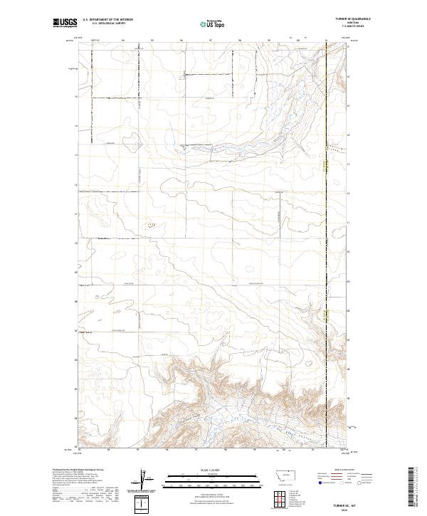
2024 Map of Turner SE
USGS Topo · Published 2024About this map
The rugged drainage patterns of north-central Montana are the defining characteristic of this landscape along the Blaine Co Phillips Co line. Narrow, meandering channels like Black Coulee and Little Jewel Coulee carve through the high plains, illustrating the erosional forces that have shaped this portion of the northern frontier. The terrain transitions from flat, surveyed agricultural sections in the north to increasingly complex coulees and breaks in the south, where the local topography becomes more pronounced.
Find a feature on this map
18 named features on this map. Tap any name to fly to it.
Don’t see what you’re looking for? This feature index may not catch every label — zoom into the map to look around manually.
Map Details
Editions of this 2024 Turner SE Map
This is the sole edition of this map. No revisions or reprints were ever made.
Other maps of this area

1920 · Avery
USGS Topo · 1:125,000

1953 · Havre
USGS Topo · 1:250,000

1957 · Havre
USGS Topo · 1:250,000

1958 · Havre
USGS Topo · 1:250,000

1984 · Chapman
USGS Topo · 1:24,000

1984 · Emerick Bench
USGS Topo · 1:24,000
1984 · Chapman NW
USGS Topo · 1:24,000

1984 · Turner
USGS Topo · 1:24,000

1984 · Turner NE
USGS Topo · 1:24,000
1984 · Down Reservoir NW
USGS Topo · 1:24,000