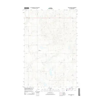
2014 Map of Turtle Creek NE
USGS Topo · Published 2014About this map
Johnson Private Airport serves as a lone modern landmark in this prairie landscape of central McLean County. The terrain is defined by a dense network of glacial kettles and depressions, typical of the Missouri Coteau region. This 2014 survey reveals a rigid section-line road system that organizes the rural acreage, with corridors like 14th Ave NW and 5th St NW forming a geometric grid across the undulating land. The presence of Main St in the lower portion of the map suggests a focal point for local transit among the scattered wetlands. While contemporary in its data, the map preserves the exact alignment of these county routes, which often follow the same paths established during the original homesteading era of North Dakota.
Find a feature on this map
22 named features on this map. Tap any name to fly to it.
Don’t see what you’re looking for? This feature index may not catch every label — zoom into the map to look around manually.
Map Details
Editions of this 2014 Turtle Creek NE Map
This is the sole edition of this map. No revisions or reprints were ever made.
Other maps of this area

1945 · Pelican Lake
USGS Topo · 1:62,500

1947 · Pelican Lake
USGS Topo · 1:62,500

1947 · Turtle Lake
USGS Topo · 1:62,500

1949 · Turtle Creek
USGS Topo · 1:62,500

1954 · McClusky
USGS Topo · 1:250,000

1958 · McClusky
USGS Topo · 1:250,000

1959 · Mercer
USGS Topo · 1:24,000

1959 · Mercer SW
USGS Topo · 1:24,000

1961 · Turtle Creek SW
USGS Topo · 1:24,000

1961 · Turtle Lake
USGS Topo · 1:24,000