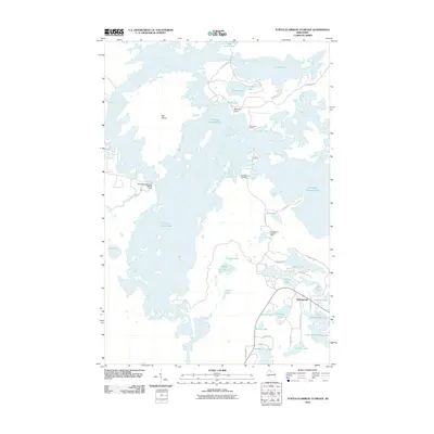
2010 Map of Turtle-Flambeau Flowage
USGS Topo · Published 2010About this map
Flambeau Flowage 666 dominates this Northwoods landscape, its complex shoreline and scattered islands shaped by the Flambeau Reservoir WP268 Dam. The map documents the northern Wisconsin wilderness at the beginning of the twenty-first century, centered on the Flambeau River watershed. The settlement of Springstead serves as the primary hub in the southeastern corner, situated near Upper Springstead Lake and Lower Springstead Lake.
Find a feature on this map
45 named features on this map. Tap any name to fly to it.
Don’t see what you’re looking for? This feature index may not catch every label — zoom into the map to look around manually.
Map Details
Editions of this 2010 Turtle-Flambeau Flowage Map
This is the sole edition of this map. No revisions or reprints were ever made.
Other maps of this area

1940 · Mercer
USGS Topo · 1:48,000

1940 · Butternut
USGS Topo · 1:48,000

1941 · Park Falls
USGS Topo · 1:48,000

1941 · Pike Lake
USGS Topo · 1:48,000

1942 · Pike Lake
USGS Topo · 1:48,000

1943 · Park Falls
USGS Topo · 1:48,000

1945 · Mercer
USGS Topo · 1:48,000

1947 · Park Falls
USGS Topo · 1:48,000

1947 · Butternut
USGS Topo · 1:48,000

1947 · Mercer
USGS Topo · 1:48,000