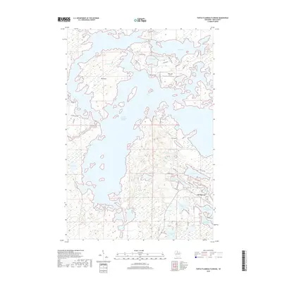
2018 Map of Turtle-Flambeau Flowage
USGS Topo · Published 2018About this map
The Turtle Flambeau Flowage dominates this landscape, created by the damming of the Flambeau River and the subsequent merging of numerous natural lakes and river channels. This complex hydrography is characterized by hundreds of small islands and jagged peninsulas, including the prominent Big Island and Norway Point. The eastern edge of the flowage is punctuated by remnants of the original lake system, such as Trude Lake, Sand Lake, and Nokomis Lake, which maintain their distinct names despite being hydrologically connected to the larger reservoir.
Find a feature on this map
56 named features on this map. Tap any name to fly to it.
Don’t see what you’re looking for? This feature index may not catch every label — zoom into the map to look around manually.
Map Details
Editions of this 2018 Turtle-Flambeau Flowage Map
This is the sole edition of this map. No revisions or reprints were ever made.
Other maps of this area

1940 · Mercer
USGS Topo · 1:48,000

1940 · Butternut
USGS Topo · 1:48,000

1941 · Park Falls
USGS Topo · 1:48,000

1941 · Pike Lake
USGS Topo · 1:48,000

1942 · Pike Lake
USGS Topo · 1:48,000

1943 · Park Falls
USGS Topo · 1:48,000

1945 · Mercer
USGS Topo · 1:48,000

1947 · Park Falls
USGS Topo · 1:48,000

1947 · Butternut
USGS Topo · 1:48,000

1947 · Mercer
USGS Topo · 1:48,000