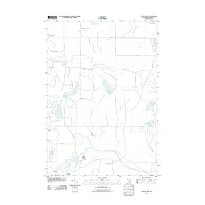
2011 Map of Turtle Lake
USGS Topo · Published 2011About this map
North Branch Au Sable River and Turtle Creek define the geography of this Otsego County landscape, where the headwaters of several river systems meet. The area is characterized by numerous glacial lakes and specialized river landings, including Whites Landing, Lower Chub Landing, and Farrar Landing. These sites, along with the Chub Lake Fire Tower, point to a history tied closely to forestry and watershed management. Private ranching footprints are evident through established properties like the Triple K Ranch, Bam Net Rnch, and Chub River Ranch. While much of the land is accessed via a network of local trails and roads such as Old Jail House Rd and Bass Lake Landing Rd, the prominence of Rosecrans Hill provides a distinct topographic landmark amidst the water-heavy terrain. This survey provides a clear view of the rural Otsego backcountry as it appeared before more recent developments.
Find a feature on this map
76 named features on this map. Tap any name to fly to it.
Don’t see what you’re looking for? This feature index may not catch every label — zoom into the map to look around manually.
Map Details
Editions of this 2011 Turtle Lake Map
This is the sole edition of this map. No revisions or reprints were ever made.
Other maps of this area

1949 · Lewiston
USGS Topo · 1:62,500

1949 · Otsego Lake
USGS Topo · 1:62,500

1950 · Johannesburg
USGS Topo · 1:24,000

1950 · Lovells
USGS Topo · 1:24,000

1950 · Turtle Lake
USGS Topo · 1:24,000

1951 · K P Lake
USGS Topo · 1:24,000

1951 · Big Bradford Lake
USGS Topo · 1:24,000

1951 · Lovells
USGS Topo · 1:24,000

1951 · Turtle Lake
USGS Topo · 1:24,000

1951 · Otsego Lake
USGS Topo · 1:24,000
Featured Places
- Chester Township, MI
- Farrar Landing, MI
- Bagley Township, MI
- Otsego Lake Township, MI
- Lower Chub Landing, MI