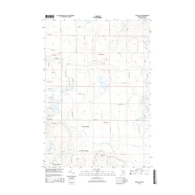
2014 Map of Turtle Lake
USGS Topo · Published 2014About this map
Turtle Lake and the winding course of the North Branch Au Sable River anchor this Michigan landscape, revealing a region defined by its hydrography and seasonal landing sites. The map documents several riverside points such as Whites Landing, Lower Chub Landing, and Farrar Landing, which suggest a history of water-access recreation or earlier river-based industry. The terrain is dotted with numerous kettle lakes, including Opal Lake, Grass Lake, and Lower Chub Lake, interspersed with glacial landforms like Rosecrans Hill. The dense network of trails and roads, such as Tomahawk Trl and McCoy Rd, illustrates the area's transition into a modern recreational destination. In the northern reaches, the S Br Pigeon River and Oley Lake mark the drainage divides, while the presence of the Net Rnch indicates localized private land use amidst the many public-named lakes.
Find a feature on this map
86 named features on this map. Tap any name to fly to it.
Don’t see what you’re looking for? This feature index may not catch every label — zoom into the map to look around manually.
Map Details
Editions of this 2014 Turtle Lake Map
This is the sole edition of this map. No revisions or reprints were ever made.
Other maps of this area

1949 · Lewiston
USGS Topo · 1:62,500

1949 · Otsego Lake
USGS Topo · 1:62,500

1950 · Johannesburg
USGS Topo · 1:24,000

1950 · Lovells
USGS Topo · 1:24,000

1950 · Turtle Lake
USGS Topo · 1:24,000

1951 · K P Lake
USGS Topo · 1:24,000

1951 · Big Bradford Lake
USGS Topo · 1:24,000

1951 · Lovells
USGS Topo · 1:24,000

1951 · Turtle Lake
USGS Topo · 1:24,000

1951 · Otsego Lake
USGS Topo · 1:24,000
Featured Places
- Chester Township, MI
- Farrar Landing, MI
- Bagley Township, MI
- Otsego Lake Township, MI
- Lower Chub Landing, MI