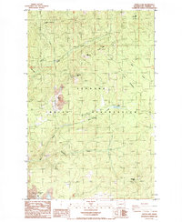
1985 Map of Turtle Lake
USGS Topo · Published 1985About this map
The Spokane Indian Reservation defines this portion of Stevens County, showing a landscape shaped by mid-century mineral extraction and high-country landmarks. Extensive industrial footprints are visible at the Sherwood Mine, characterized by large tailings piles and tanks, alongside the Midnight Mine and its associated mine dump. These operations highlight the importance of the region's geology during the Cold War era.
Find a feature on this map
23 named features on this map. Tap any name to fly to it.
Don’t see what you’re looking for? This feature index may not catch every label — zoom into the map to look around manually.
Map Details
Editions of this 1985 Turtle Lake Map
This is the sole edition of this map. No revisions or reprints were ever made.
Other maps of this area

1927 · Chewelah
USGS Topo · 1:125,000

1930 · Chewelah
USGS Topo · 1:125,000

1944 · Wellpinit
USGS Topo · 1:62,500

1948 · Hunters
USGS Topo · 1:62,500

1948 · Turtle Lake
USGS Topo · 1:62,500

1950 · Turtle Lake
USGS Topo · 1:62,500

1950 · Hunters
USGS Topo · 1:62,500

1953 · Wellpinit
USGS Topo · 1:62,500

1953 · Ritzville
USGS Topo · 1:250,000

1954 · Okanogan
USGS Topo · 1:250,000