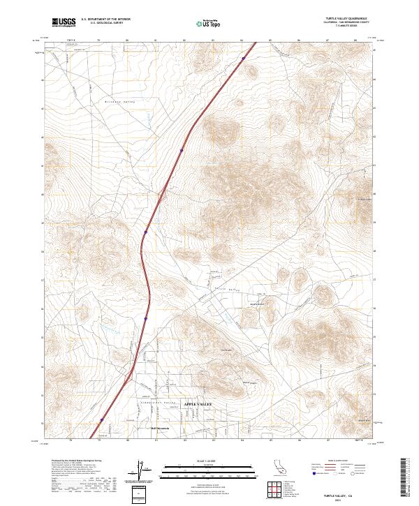
2021 Map of Turtle Valley
USGS Topo · Published 2021About this map
Apple Valley serves as the focal point for development in this high desert landscape, where the transition from residential grids to open terrain is marked by the community of Bell Mountain and the Sidewinder Valley. The northern half of the region is defined by prominent topographical features such as Stoddard Mtn and the sweeping Brisbane Valley. These natural landforms influence the paths of drainage systems like Bell Mountain Wash and Wild Wash, which cut through the desert floor. Historical travel routes and modern connectivity are illustrated by the presence of the Overland Trl and Panamint Trl in the north, while a dense network of local roads such as Dale Evans Pkwy and Colusa Rd supports the growing southern settlements. This area reflects a balance between late-twentieth-century residential expansion and the preserved arid stretches of the Mojave Desert.
Find a feature on this map
60 named features on this map. Tap any name to fly to it.
Don’t see what you’re looking for? This feature index may not catch every label — zoom into the map to look around manually.
Map Details
Editions of this 2021 Turtle Valley Map
This is the sole edition of this map. No revisions or reprints were ever made.
Other maps of this area

1932 · Barstow
USGS Topo · 1:125,000

1934 · Barstow
USGS Topo · 1:125,000

1953 · San Bernardino
USGS Topo · 1:250,000

1956 · San Bernardino
USGS Topo · 1:250,000
1956 · Victorville
USGS Topo · 1:24,000

1956 · Hawes
USGS Topo · 1:62,500

1956 · Barstow
USGS Topo · 1:62,500

1956 · Helendale
USGS Topo · 1:24,000
1956 · Victorville
USGS Topo · 1:62,500

1957 · Apple Valley
USGS Topo · 1:62,500