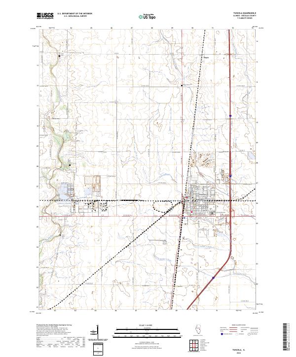
2024 Map of Tuscola
USGS Topo · Published 2024About this map
Tuscola serves as the regional hub for this portion of central Illinois, centered around the Douglas County Courthouse and a grid of residential and commercial streets. The landscape is defined by the headwaters and tributaries of the Kaskaskia River, including Hayes Branch, Hackett Branch, and the Scattering Fork. Significant industrial development is evident to the west at Ficklin, where the National Petroleum Chemical Company Plant Reservoir sits adjacent to the rail lines.
Find a feature on this map
83 named features on this map. Tap any name to fly to it.
Don’t see what you’re looking for? This feature index may not catch every label — zoom into the map to look around manually.
Map Details
Editions of this 2024 Tuscola Map
This is the sole edition of this map. No revisions or reprints were ever made.
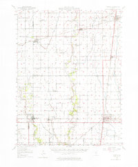
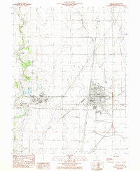
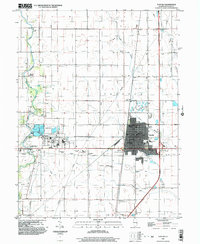
Historical Maps of North Prairie Acres Through Time
4 maps found