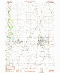
1983 Map of Tuscola
USGS Topo · Published 1983About this map
The Illinois Central Gulf and Baltimore and Ohio railroads intersect at the heart of Tuscola, anchoring a landscape shaped by industrial transport and prairie agriculture. This 1980s survey captures the city's infrastructure at a peak of modernization, from the Jarman Memorial Hospital and the Tuscola Airport to the large industrial footprint at Ficklin. Beyond the urban core, the Kaskaskia River snakes through the western portion of the quadrangle, passing the curiously named settlement of Chicken Bristle. The rural reaches of Garrett and Bourbon are dotted with family and memorial grounds, including Bache Memorial Cem, Lewis Cem, and both the Upper Lester Cem and Lower Lester Cem. These small cemeteries and country churches like Cartwright Ch offer significant touchpoints for genealogists tracking the deep-rooted families of Douglas County.
Find a feature on this map
36 named features on this map. Tap any name to fly to it.
Don’t see what you’re looking for? This feature index may not catch every label — zoom into the map to look around manually.
Map Details
Editions of this 1983 Tuscola Map
This is the sole edition of this map. No revisions or reprints were ever made.
Other maps of this area

1935 · Arcola
USGS Topo · 1:48,000

1936 · Oakland
USGS Topo · 1:48,000

1940 · Arcola
USGS Topo · 1:62,500

1942 · Oakland
USGS Topo · 1:62,500

1950 · Tuscola
USGS Topo · 1:62,500

1956 · Villa Grove
USGS Topo · 1:62,500

1958 · Decatur
USGS Topo · 1:250,000

1961 · Decatur
USGS Topo · 1:250,000
1975 · Tuscola NE
USGS Topo · 1:24,000
1975 · Tuscola NW
USGS Topo · 1:24,000