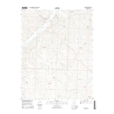
2015 Map of Tuscumbia
USGS Topo · Published 2015About this map
The Osage River carves a deep path through the Miller County landscape, anchoring the settlement of Tuscumbia on its northern bank. This 2015 record shows the town’s positioning against Cedar Bluffs, where the local road network, including Ball Park River Rd, follows the river's winding course. To the south, the community of Ulman sits at a higher elevation among a series of named drainages like Cattail Cr and Dog Cr.
Find a feature on this map
67 named features on this map. Tap any name to fly to it.
Don’t see what you’re looking for? This feature index may not catch every label — zoom into the map to look around manually.
Map Details
Editions of this 2015 Tuscumbia Map
This is the sole edition of this map. No revisions or reprints were ever made.
Other maps of this area

1888 · Versailles
USGS Topo · 1:125,000

1888 · Tuscumbia
USGS Topo · 1:125,000

1893 · Versailles
USGS Topo · 1:125,000

1894 · Tuscumbia
USGS Topo · 1:125,000

1904 · Eldon
USGS Topo · 1:62,500

1932 · Versailles No 4
USGS Topo · 1:48,000

1933 · Iberia
USGS Topo · 1:62,500

1934 · Toronto
USGS Topo · 1:24,000

1934 · Bagnell
USGS Topo · 1:24,000
1935 · Eldon
USGS Topo · 1:24,000