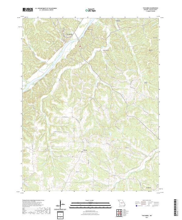
2021 Map of Tuscumbia
USGS Topo · Published 2021About this map
Tuscumbia serves as the focal point of this Miller County landscape, situated where the Osage River bends past the prominent Cedar Bluffs. The town's significance as a local center is anchored by the Miller County Courthouse, while the surrounding terrain is defined by a series of steep drainages and ridges, including Wilson Hollow and Turn Back Ridge. The settlement pattern follows the high ground between these features, with the community of Ulman located south of the river and Watkins appearing in the southeastern corner. A network of country roads, such as Ulman Ridge Rd and Pea Ridge Rd, connects these upland areas. Notable water features like Bear Spring and Cave Spring indicate the karst-influenced geology of the region, while Lake Lottawatch provides a rare point of standing water amidst the winding creeks of Cattail Cr and Gum Creek.
Find a feature on this map
70 named features on this map. Tap any name to fly to it.
Don’t see what you’re looking for? This feature index may not catch every label — zoom into the map to look around manually.
Map Details
Editions of this 2021 Tuscumbia Map
This is the sole edition of this map. No revisions or reprints were ever made.
Other maps of this area

1888 · Versailles
USGS Topo · 1:125,000

1888 · Tuscumbia
USGS Topo · 1:125,000

1893 · Versailles
USGS Topo · 1:125,000

1894 · Tuscumbia
USGS Topo · 1:125,000

1904 · Eldon
USGS Topo · 1:62,500

1932 · Versailles No 4
USGS Topo · 1:48,000

1933 · Iberia
USGS Topo · 1:62,500

1934 · Toronto
USGS Topo · 1:24,000

1934 · Bagnell
USGS Topo · 1:24,000
1935 · Eldon
USGS Topo · 1:24,000