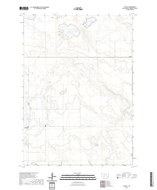
2021 Map of Tuthill
USGS Topo · Published 2021About this map
Little White River meanders through this portion of Bennett County, defining a landscape of wetlands and prairie waterways. Near the settlement of Tuthill, the Tuthill Cem serves as a localized landmark for genealogists and local historians tracking early South Dakota families. The area is characterized by several natural catchments and basins, including Twin Lakes, White Lake, and Silver Lake to the north, which collect runoff from various drainages such as Pass Cr and Lake Cr. To the east, the small community of Vetal sits near the upper reaches of the river system. The map reflects a predominantly rural agricultural and ranching environment, where township lines like t37n r35w and long stretches of 293rd ST and 237 Ave form the primary infrastructure connecting these remote prairie outposts.
Find a feature on this map
19 named features on this map. Tap any name to fly to it.
Don’t see what you’re looking for? This feature index may not catch every label — zoom into the map to look around manually.
Map Details
Editions of this 2021 Tuthill Map
This is the sole edition of this map. No revisions or reprints were ever made.
Other maps of this area

1955 · Martin
USGS Topo · 1:250,000

1958 · Martin
USGS Topo · 1:250,000

1981 · Patricia
USGS Topo · 1:25,000

1981 · Phantom Lake
USGS Topo · 1:25,000

1981 · Martin
USGS Topo · 1:25,000

1981 · Blackpipe
USGS Topo · 1:25,000

1981 · Scotchman Lake
USGS Topo · 1:25,000

1981 · Tuthill
USGS Topo · 1:25,000

1983 · Martin
USGS Topo · 1:100,000
2012 · Scotchman Lake
USGS Topo · 1:24,000