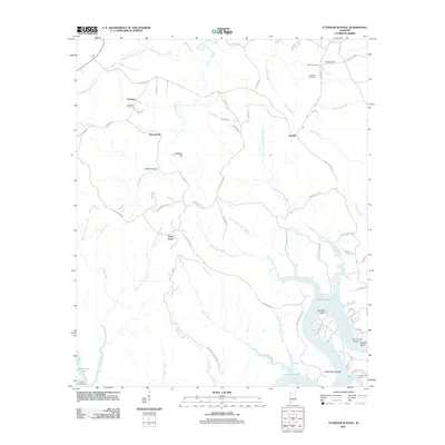
2011 Map of Tutwiler School
USGS Topo · Published 2011About this map
Bankhead Lake dominates the southeastern corner of this landscape, its waters filling the convoluted bends of the Black Warrior River system. The terrain is defined by its drainage into the lake, featuring a dense network of tributaries such as Walker County Shoal Creek and Clifty Creek. Small communities like Fairview, Browntown, and Tutwiler are scattered across the higher ground, connected by a winding road network that includes Tutwiler Rd and Franklin Ferry Rd. The presence of High Hill Fire Tower and Miller Cemetery near Chapel Hill suggests a traditional rural structure surviving alongside specialized developments like Drummond Airport and the riverside Henderson Camp. This 2011 survey captures the area's transition between secluded upland settlements and the active recreational and industrial access points along the impounded river.
Find a feature on this map
70 named features on this map. Tap any name to fly to it.
Don’t see what you’re looking for? This feature index may not catch every label — zoom into the map to look around manually.
Map Details
Editions of this 2011 Tutwiler School Map
This is the sole edition of this map. No revisions or reprints were ever made.
Other maps of this area

1893 · Jasper
USGS Topo · 1:125,000

1899 · Brookwood
USGS Topo · 1:125,000

1927 · Adger
USGS Topo · 1:48,000

1929 · Searles
USGS Topo · 1:48,000

1932 · Yolande
USGS Topo · 1:62,500

1934 · Searles
USGS Topo · 1:62,500

1935 · Port Birmingham
USGS Topo · 1:48,000

1935 · Yolande
USGS Topo · 1:62,500

1938 · Port Birmingham
USGS Topo · 1:62,500

1949 · Parrish
USGS Topo · 1:24,000