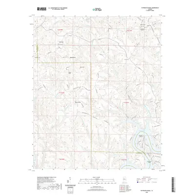
2020 Map of Tutwiler School
USGS Topo · Published 2020About this map
Browntown and the rural hills of northern Alabama are documented here where the borders of Walker, Tuscaloosa, and Jefferson counties converge. The landscape is defined by the winding course of the Black Warrior River, appearing here as Bankhead Lake, which cuts through the southern reaches of the quadrangle. Notable landmarks like Humber Bend and Black Rock Shoals illustrate the river's historical geography, while upland settlements like Fairview and Chapel Hill sit among the ridges. Local infrastructure is anchored by the Tutwiler School and several family-named landmarks including Wallace Hill and Wallace Bridge. Genealogists may find interest in the documented locations of Fairview Cem and Miller Cem, alongside numerous country roads such as Warrior Cemetary Rd and Tiger Mine Rd that trace the area's development.
Find a feature on this map
92 named features on this map. Tap any name to fly to it.
Don’t see what you’re looking for? This feature index may not catch every label — zoom into the map to look around manually.
Map Details
Editions of this 2020 Tutwiler School Map
This is the sole edition of this map. No revisions or reprints were ever made.
Other maps of this area

1893 · Jasper
USGS Topo · 1:125,000

1899 · Brookwood
USGS Topo · 1:125,000

1927 · Adger
USGS Topo · 1:48,000

1929 · Searles
USGS Topo · 1:48,000

1932 · Yolande
USGS Topo · 1:62,500

1934 · Searles
USGS Topo · 1:62,500

1935 · Port Birmingham
USGS Topo · 1:48,000

1935 · Yolande
USGS Topo · 1:62,500

1938 · Port Birmingham
USGS Topo · 1:62,500

1949 · Parrish
USGS Topo · 1:24,000