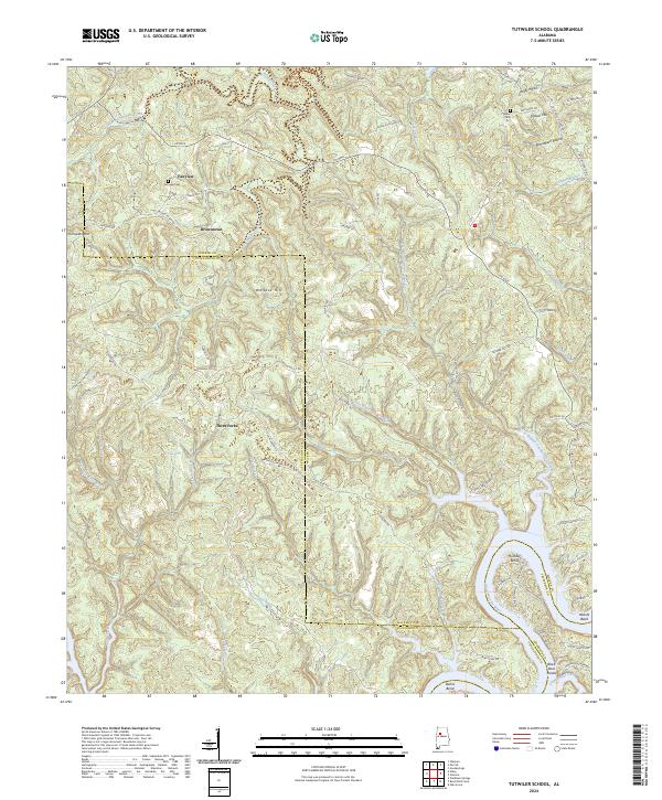
2024 Map of Tutwiler School
USGS Topo · Published 2024About this map
The Black Warrior River carves a deep path through the southeastern corner of this region, creating distinctive landforms like Humber Bend and Heards Bend. This topographic study reveals a landscape defined by the convergence of the Walker, Tuscaloosa, and Jefferson county lines amidst a complex network of waterways including White Oak Creek and the forks of Clifty Creek. Small communities and family-named landmarks are scattered throughout the upland ridges, with Fairview and Browntown serving as primary local points of reference.
Find a feature on this map
121 named features on this map. Tap any name to fly to it.
Don’t see what you’re looking for? This feature index may not catch every label — zoom into the map to look around manually.
Map Details
Editions of this 2024 Tutwiler School Map
This is the sole edition of this map. No revisions or reprints were ever made.
Other maps of this area

1893 · Jasper
USGS Topo · 1:125,000

1899 · Brookwood
USGS Topo · 1:125,000

1927 · Adger
USGS Topo · 1:48,000

1929 · Searles
USGS Topo · 1:48,000

1932 · Yolande
USGS Topo · 1:62,500

1934 · Searles
USGS Topo · 1:62,500

1935 · Port Birmingham
USGS Topo · 1:48,000

1935 · Yolande
USGS Topo · 1:62,500

1938 · Port Birmingham
USGS Topo · 1:62,500

1949 · Parrish
USGS Topo · 1:24,000