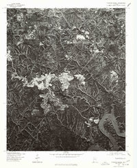
1975 Map of Tutwiler School
USGS Topo · Published 1977About this map
Bankhead Lake and the Black Warrior River anchor the southern reaches of this 1970s orthophotograph, where the landscape of Walker County is defined by heavy industry and natural waterways. This specific type of survey, produced by the Geological Survey in cooperation with the Soil Conservation Service, utilizes rectified aerial photography to provide a clear view of land-use patterns often obscured by traditional topographic lines. The imagery reveals the sprawling footprints of surface mining operations cutting through the timbered hills of central Alabama, creating a stark visual contrast between the natural forest cover and the tiered, industrial excavations. Away from the river, the Tutwiler School stands as a primary landmark in a region where the topography is shaped as much by the extraction of resources as it is by the winding course of the river itself.
Find a feature on this map
3 named features on this map. Tap any name to fly to it.
Don’t see what you’re looking for? This feature index may not catch every label — zoom into the map to look around manually.
Map Details
Editions of this 1975 Tutwiler School Map
This is the sole edition of this map. No revisions or reprints were ever made.
Other maps of this area

1893 · Jasper
USGS Topo · 1:125,000

1899 · Brookwood
USGS Topo · 1:125,000

1927 · Adger
USGS Topo · 1:48,000

1929 · Searles
USGS Topo · 1:48,000

1932 · Yolande
USGS Topo · 1:62,500

1934 · Searles
USGS Topo · 1:62,500

1935 · Port Birmingham
USGS Topo · 1:48,000

1935 · Yolande
USGS Topo · 1:62,500

1938 · Port Birmingham
USGS Topo · 1:62,500

1949 · Parrish
USGS Topo · 1:24,000