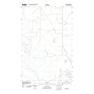
2011 Map of Tweedie
USGS Topo · Published 2011About this map
Tweedie and Blanchard Valley anchor this landscape along the border of Washington and Idaho in the early 21st century. The map illustrates a rural network of roads and water features, characterized by the winding paths of Elmer Creek and Ross Creek flowing through the valley floors. In the southeastern corner, residential and recreational development is evident around Lake San Souci, supported by the Stoneridge Dam and Blanchard Creek Dam.
Find a feature on this map
52 named features on this map. Tap any name to fly to it.
Don’t see what you’re looking for? This feature index may not catch every label — zoom into the map to look around manually.
Map Details
Editions of this 2011 Tweedie Map
This is the sole edition of this map. No revisions or reprints were ever made.
Other maps of this area

1901 · Sandpoint
USGS Topo · 1:125,000

1901 · Spokane
USGS Topo · 1:125,000

1903 · Rathdrum
USGS Topo · 1:125,000

1911 · Priest Lake
USGS Topo · 1:250,000

1911 · Sandpoint
USGS Topo · 1:125,000

1913 · Priest Lake
USGS Topo · 1:250,000

1936 · Newport
USGS Topo · 1:96,000

1942 · Newport
USGS Topo · 1:125,000

1943 · Mt Spokane
USGS Topo · 1:62,500

1950 · Mt Spokane
USGS Topo · 1:62,500