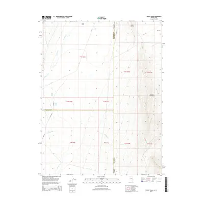
2015 Map of Tweedy Wash
USGS Topo · Published 2015About this map
Hamlin Valley defines the western portion of this high-desert landscape where the border between Nevada and Utah meets the line between White Pine and Millard counties. The terrain transitions from the alluvial floor of the valley to the soaring elevations of the Mountain Home Range in the east, dominated by peaks like Needle Point Mtn. Water is the primary driver of geography here, with seasonal drainages such as Big Spring Wash and Tweedy Wash carving the slopes. Localized water sources including North Little Springs, South Little Springs, and the uniquely named The Pots indicate reliable points for historical livestock and travel in an otherwise arid Great Basin environment. A network of rural connectors like Big Springs Rd and Hydewell Rd links the scattered springs and natural features across these basin-and-range formations.
Find a feature on this map
29 named features on this map. Tap any name to fly to it.
Don’t see what you’re looking for? This feature index may not catch every label — zoom into the map to look around manually.
Map Details
Editions of this 2015 Tweedy Wash Map
This is the sole edition of this map. No revisions or reprints were ever made.
Other maps of this area
1949 · Garrison
USGS Topo · 1:62,500
1951 · Garrison
USGS Topo · 1:62,500

1953 · Richfield
USGS Topo · 1:250,000

1956 · Lund
USGS Topo · 1:250,000

1958 · Richfield
USGS Topo · 1:250,000

1960 · Lund
USGS Topo · 1:250,000
1960 · Burbank Hills
USGS Topo · 1:62,500
1971 · Mountain Home Pass
USGS Topo · 1:24,000
1971 · Mormon Gap
USGS Topo · 1:24,000
1972 · Miller Wash
USGS Topo · 1:24,000