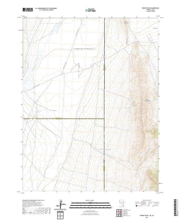
2021 Map of Tweedy Wash
USGS Topo · Published 2021About this map
Hamlin Valley occupies the center of this 2021 topographic survey, where the borders of Nevada and Utah meet. The map documents a desolate high-desert landscape defined by complex drainage systems and the imposing Mountain Home Range to the east. Water sources, though seemingly scarce, are precisely mapped through features like North Little Springs, South Little Springs, and the uniquely named The Pots at the northern edge.
Find a feature on this map
22 named features on this map. Tap any name to fly to it.
Don’t see what you’re looking for? This feature index may not catch every label — zoom into the map to look around manually.
Map Details
Editions of this 2021 Tweedy Wash Map
This is the sole edition of this map. No revisions or reprints were ever made.
Other maps of this area

1949 · Garrison
USGS Topo · 1:62,500

1951 · Garrison
USGS Topo · 1:62,500

1953 · Richfield
USGS Topo · 1:250,000

1956 · Lund
USGS Topo · 1:250,000

1958 · Richfield
USGS Topo · 1:250,000

1960 · Lund
USGS Topo · 1:250,000

1960 · Burbank Hills
USGS Topo · 1:62,500

1971 · Mountain Home Pass
USGS Topo · 1:24,000

1971 · Mormon Gap
USGS Topo · 1:24,000

1972 · Miller Wash
USGS Topo · 1:24,000