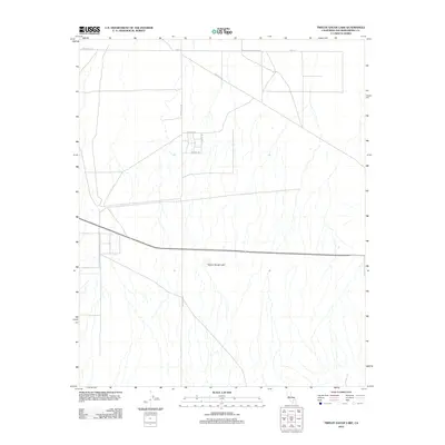
2012 Map of Twelve Gauge Lake
USGS Topo · Published 2012About this map
Twelve Gauge Lake serves as the central focal point of this arid San Bernardino County landscape. The terrain is defined by a sparse but deliberate network of desert roads and trails that intersect at right angles, suggesting a structured approach to land division and utility access in this dry basin. Prominent thoroughfares such as Helendale Rd and Harper Lake Rd provide the primary north-south orientation through the region, while Santa Fe Ave cuts diagonally across the northern sector, likely reflecting a historical transit corridor. A small cluster of residential or utility streets including Phoenix Rd, El Centro Rd, and Salinas Rd indicates a localized pocket of development south of Roy St. The presence of Powerline Rd further emphasizes the area's role in regional infrastructure, supporting the delivery of resources across the high desert.
Find a feature on this map
9 named features on this map. Tap any name to fly to it.
Don’t see what you’re looking for? This feature index may not catch every label — zoom into the map to look around manually.
Map Details
Editions of this 2012 Twelve Gauge Lake Map
This is the sole edition of this map. No revisions or reprints were ever made.
Other maps of this area

1915 · Searles Lake
USGS Topo · 1:250,000

1932 · Barstow
USGS Topo · 1:125,000

1934 · Barstow
USGS Topo · 1:125,000

1947 · Trona
USGS Topo · 1:250,000

1948 · Trona
USGS Topo · 1:250,000

1953 · San Bernardino
USGS Topo · 1:250,000

1953 · Trona
USGS Topo · 1:250,000

1955 · Opal Mountain
USGS Topo · 1:62,500

1956 · San Bernardino
USGS Topo · 1:250,000

1956 · Fremont Peak
USGS Topo · 1:62,500