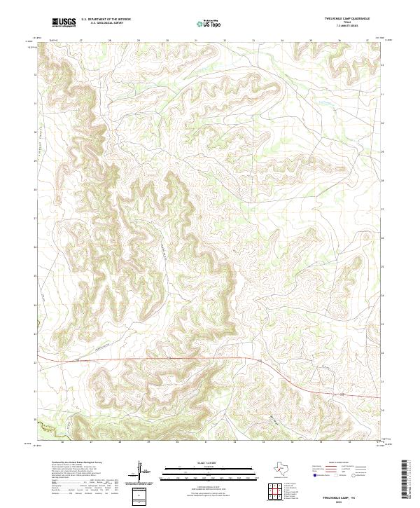
2022 Map of Twelvemile Camp
USGS Topo · Published 2022About this map
The Pecos River serves as the southwestern boundary for this corner of West Texas, separating the terrain from neighboring Pecos Co. This section of the Edwards Plateau landscape is defined by its dramatic drainage networks, with ephemeral waterways like Twelvemile Cr and deep-cut features such as Simpson Canyon and Deer Canyon dissecting the high ground. The sparse ranching infrastructure is visible through a network of unpaved corridors including Thompson Ranch Rd, Big Elk Rd, and River Rd. These routes provide essential access across the dry creek beds and ridgelines of Crockett Co, illustrating the vast, open land management patterns typical of the region. This 2022 survey captures the area in its contemporary state, documenting the exact layout of private ranch roads and topographical relief in a place where water and elevation dictate all human movement.
Find a feature on this map
9 named features on this map. Tap any name to fly to it.
Don’t see what you’re looking for? This feature index may not catch every label — zoom into the map to look around manually.
Map Details
Editions of this 2022 Twelvemile Camp Map
This is the sole edition of this map. No revisions or reprints were ever made.
Other maps of this area

1928 · Rankin
USGS Topo · 1:125,000

1929 · Sheffield
USGS Topo · 1:125,000

1954 · Sonora
USGS Topo · 1:250,000

1954 · San Angelo
USGS Topo · 1:250,000

1958 · Sonora
USGS Topo · 1:250,000

1958 · San Angelo
USGS Topo · 1:250,000

1965 · San Angelo
USGS Topo · 1:250,000

1967 · Twelvemile Camp
USGS Topo · 1:24,000

1967 · Divide Country
USGS Topo · 1:24,000

1967 · Deer Canyon
USGS Topo · 1:24,000