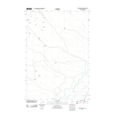
2011 Map of Twin Bridges SW
USGS Topo · Published 2011About this map
Mining operations dominate the high country and drainage basins in this section of Madison County. Names like the Alaska Mine, Elizabeth Mine, and Never Fail Mine suggest a landscape shaped by mineral pursuit, with numerous labeled prospects such as the Anything Mine and Full House Mine scattered across the northern terrain. These sites follow the primary watercourses, including Rochester Creek and Nez Perce Creek, as they flow toward the agricultural bottomlands.
Find a feature on this map
31 named features on this map. Tap any name to fly to it.
Don’t see what you’re looking for? This feature index may not catch every label — zoom into the map to look around manually.
Map Details
Editions of this 2011 Twin Bridges SW Map
This is the sole edition of this map. No revisions or reprints were ever made.
Other maps of this area

1893 · Dillon
USGS Topo · 1:250,000

1955 · Dillon
USGS Topo · 1:250,000

1957 · Dillon
USGS Topo · 1:250,000

1958 · Dillon
USGS Topo · 1:250,000

1960 · Block Mountain
USGS Topo · 1:24,000

1960 · Twin Bridges
USGS Topo · 1:62,500

1961 · Wickiup Creek
USGS Topo · 1:24,000

1961 · Nez Perce Hollow
USGS Topo · 1:24,000

1962 · Dillon
USGS Topo · 1:250,000
1962 · Beaverhead Rock
USGS Topo · 1:24,000