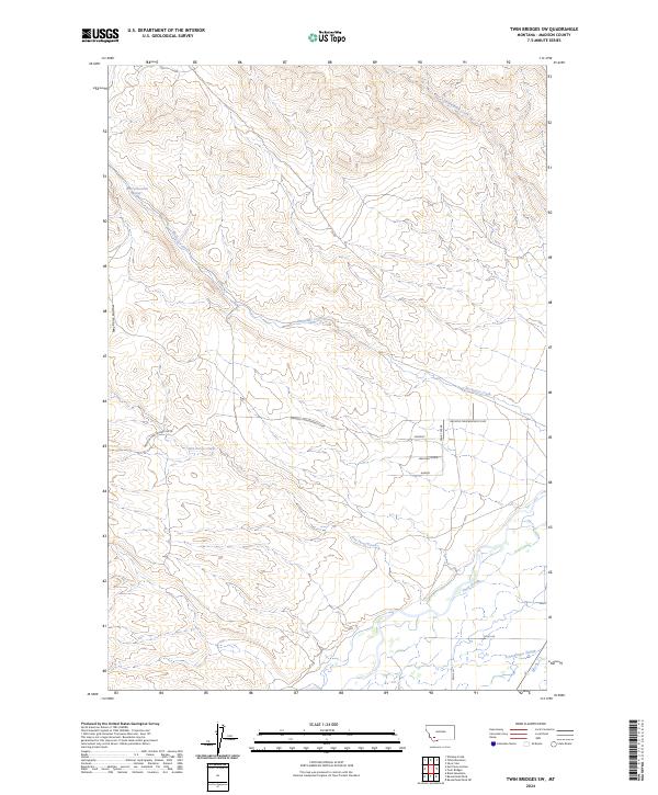
2024 Map of Twin Bridges SW
USGS Topo · Published 2024About this map
Rochester Creek and Nez Perce Creek carve through the Madison County landscape, defining the drainage patterns of this high-elevation terrain. This modern survey illustrates the enduring rural character of southwestern Montana, where transportation relies on routes like the Melrose-Twin Bridges Co Rd. The map detail reveals a specialized network of minor roads and tracks, including named ways such as Walking Horse and Sundust, which suggest private developments or ranch access points tucked into the hills. Along the southern reaches, the presence of Third Slough and Schoolhouse Slough indicates the shifting water courses near more level ground, contrasting with the narrow draws of Nez Perce Hollow. This interplay of upland drainages and valley sloughs provides a clear record of the local hydrology and contemporary land use near the 03S07W05DCDB01 Spring.
Find a feature on this map
20 named features on this map. Tap any name to fly to it.
Don’t see what you’re looking for? This feature index may not catch every label — zoom into the map to look around manually.
Map Details
Editions of this 2024 Twin Bridges SW Map
This is the sole edition of this map. No revisions or reprints were ever made.
Other maps of this area

1893 · Dillon
USGS Topo · 1:250,000

1955 · Dillon
USGS Topo · 1:250,000

1957 · Dillon
USGS Topo · 1:250,000

1958 · Dillon
USGS Topo · 1:250,000

1960 · Block Mountain
USGS Topo · 1:24,000

1960 · Twin Bridges
USGS Topo · 1:62,500

1961 · Wickiup Creek
USGS Topo · 1:24,000

1961 · Nez Perce Hollow
USGS Topo · 1:24,000

1962 · Dillon
USGS Topo · 1:250,000
1962 · Beaverhead Rock
USGS Topo · 1:24,000