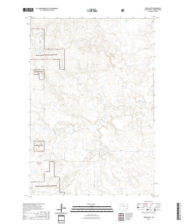
2021 Map of Twin Butte
USGS Topo · Published 2021About this map
Grand River National Grassland segments dominate this portion of the northern plains, reflecting a landscape defined by federal conservation and rangeland management. The terrain is marked by the eponymous Twin Butte, a distinctive high point that serves as a landmark for the surrounding drainage basins. A network of seasonal waterways, including Third Cr, Black Horse Butte Cr, and Twin Butte Cr, carves through the undulating topography of Corson County. The road system is sparse, primarily composed of secondary routes like Twin Butte Rd and 126th St, which provide access to these remote reaches of the Dakotas. The map illustrates a late-twentieth and early-twenty-first-century ranching environment where the interplay between public grasslands and private holdings is traced through clear section lines and township boundaries.
Find a feature on this map
16 named features on this map. Tap any name to fly to it.
Don’t see what you’re looking for? This feature index may not catch every label — zoom into the map to look around manually.
Map Details
Editions of this 2021 Twin Butte Map
This is the sole edition of this map. No revisions or reprints were ever made.
Other maps of this area

1953 · McIntosh
USGS Topo · 1:250,000

1956 · Cottonwood Creek NW
USGS Topo · 1:24,000

1956 · Cottonwood Creek SW
USGS Topo · 1:24,000

1958 · McIntosh
USGS Topo · 1:250,000

1972 · Black Horse Butte NW
USGS Topo · 1:24,000

1972 · Black Horse Butte
USGS Topo · 1:24,000

1972 · Twin Butte
USGS Topo · 1:24,000

1972 · Black Horse Butte NE
USGS Topo · 1:24,000

1980 · McIntosh
USGS Topo · 1:100,000

1982 · Glad Valley
USGS Topo · 1:24,000