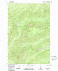
1966 Map of Twin Butte
USGS Topo · Published 1987About this map
Nez Perce National Forest land defines this portion of the Idaho backcountry, where the high-altitude terrain is carved by a network of drainage systems. The northern reaches are dominated by the heights of Pettibone Ridge, falling away toward Pettibone Creek and Squad Creek. This mid-1960s survey illustrates a landscape managed for conservation and limited access, with the southern half protected as part of the Selway-Bitterroot Wilderness. Transport is restricted to the established Pack Trail system, which winds along the high contours of Elk Ridge and Long Ridge. Water sources such as Bear Creek, Paradise Creek, and Cub Creek flow through deep-cut valleys beneath the prominent summit of Twin Butte. The map reflects a period of modern wilderness designation, recording the specific boundaries and topographical detail of these protected Idaho mountain ranges.
Find a feature on this map
15 named features on this map. Tap any name to fly to it.
Don’t see what you’re looking for? This feature index may not catch every label — zoom into the map to look around manually.
Map Details
Editions of this 1966 Twin Butte Map
2 editions found
Other maps of this area

1911 · Lolo
USGS Topo · 1:250,000

1913 · Lolo
USGS Topo · 1:250,000

1956 · Elk City
USGS Topo · 1:250,000

1956 · Hamilton
USGS Topo · 1:250,000

1959 · Hamilton
USGS Topo · 1:250,000

1960 · Elk City
USGS Topo · 1:250,000

1960 · Hamilton
USGS Topo · 1:250,000

1964 · Hamilton
USGS Topo · 1:250,000

1966 · Twin Butte
USGS Topo · 1:24,000
1966 · Mount Paloma
USGS Topo · 1:24,000