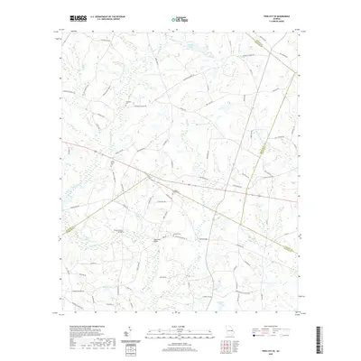
2020 Map of Twin City SE
USGS Topo · Published 2020About this map
Fifteenmile Creek and Lotts Creek define the drainage of this low-lying landscape where Bulloch, Candler, Emanuel, and Jenkins Counties converge. The terrain is characterized by a high density of small water bodies and wetlands, including Hendley Pond, Donaldson Lake, and Bowen Lake. The road network consists largely of rural routes and family-named tracks like Old Boatright Road and Hendley-Proctor Road, which weave through the agricultural and wooded plots typical of this region in the early twenty-first century.
Find a feature on this map
87 named features on this map. Tap any name to fly to it.
Don’t see what you’re looking for? This feature index may not catch every label — zoom into the map to look around manually.
Map Details
Editions of this 2020 Twin City SE Map
This is the sole edition of this map. No revisions or reprints were ever made.
Other maps of this area

1920 · Statesboro
USGS Topo · 1:62,500

1921 · Rocky Ford
USGS Topo · 1:62,500

1943 · Rocky Ford
USGS Topo · 1:62,500

1943 · Millen
USGS Topo · 1:125,000

1943 · Statesboro
USGS Topo · 1:62,500

1947 · Savannah
USGS Topo · 1:250,000

1948 · Savannah
USGS Topo · 1:250,000

1957 · Macon
USGS Topo · 1:250,000

1957 · Savannah
USGS Topo · 1:250,000

1958 · Macon
USGS Topo · 1:250,000