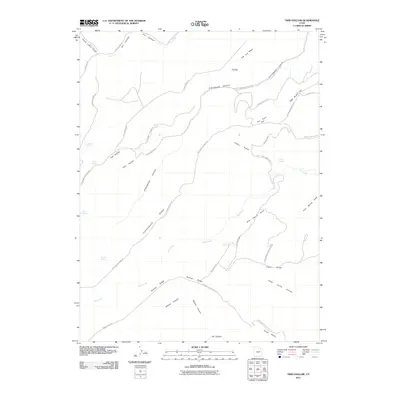
2011 Map of Twin Hollow
USGS Topo · Published 2011About this map
Twin Hollow serves as a central feature in this section of Carbon County, where a network of primitive roads and topographic ridges defines the high desert landscape. The terrain is characterized by prominent elevations such as Cottonwood Ridge and Bishop Ridge, which are accessed by a system of ranch and forest tracks including Cottonwood Ridge Rd and Bishop Ridge Rd. These pathways connect various water sources essential for livestock and local wildlife, including Buckhorn Spring, Elbow Spring, and Petes Spring.
Find a feature on this map
39 named features on this map. Tap any name to fly to it.
Don’t see what you’re looking for? This feature index may not catch every label — zoom into the map to look around manually.
Map Details
Editions of this 2011 Twin Hollow Map
This is the sole edition of this map. No revisions or reprints were ever made.
Other maps of this area

1886 · Price River
USGS Topo · 1:250,000

1896 · Price River
USGS Topo · 1:250,000

1915 · Sunnyside
USGS Topo · 1:62,500

1954 · Flat Canyon
USGS Topo · 1:62,500

1956 · Price
USGS Topo · 1:250,000

1960 · Price
USGS Topo · 1:250,000

1962 · Price
USGS Topo · 1:250,000
1968 · Cowboy Bench
USGS Topo · 1:24,000
1968 · Pinnacle Canyon
USGS Topo · 1:24,000
1968 · Currant Canyon
USGS Topo · 1:24,000