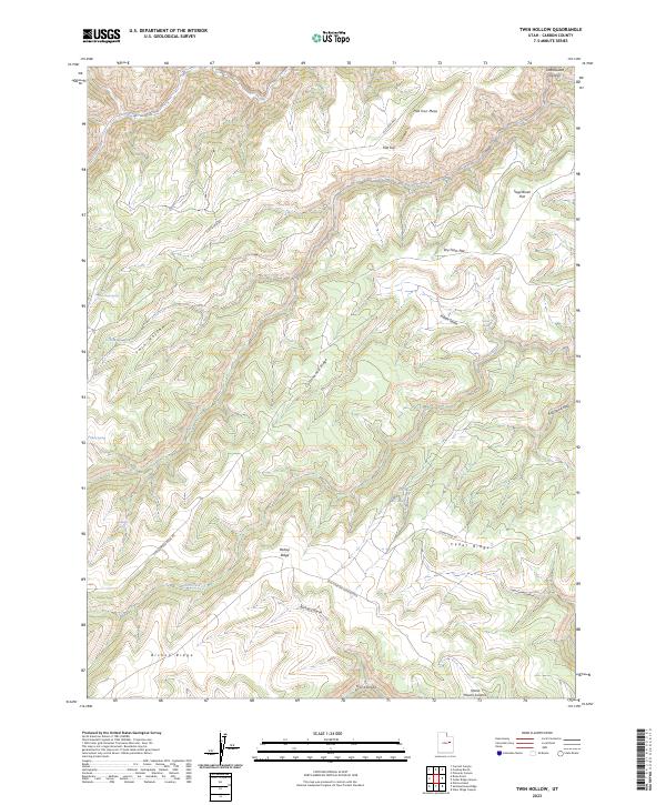
2023 Map of Twin Hollow
USGS Topo · Published 2023About this map
Flat Iron Mesa and Bishop Ridge dominate this high-desert landscape in Carbon County, Utah, where a network of plateaus and deep drainages defines the topography. The map illustrates a region structured by vertical relief, from the heights of Horse Haven Summit down into the intricate narrows of Twin Hollow and Flat Canyon. Water sources, critical in this arid environment, are specifically marked at sites like Clay Bank Spring, Buckhorn Spring, and Indian Spring.
Find a feature on this map
27 named features on this map. Tap any name to fly to it.
Don’t see what you’re looking for? This feature index may not catch every label — zoom into the map to look around manually.
Map Details
Editions of this 2023 Twin Hollow Map
This is the sole edition of this map. No revisions or reprints were ever made.
Other maps of this area

1886 · Price River
USGS Topo · 1:250,000

1896 · Price River
USGS Topo · 1:250,000

1915 · Sunnyside
USGS Topo · 1:62,500

1954 · Flat Canyon
USGS Topo · 1:62,500

1956 · Price
USGS Topo · 1:250,000

1960 · Price
USGS Topo · 1:250,000

1962 · Price
USGS Topo · 1:250,000
1968 · Cowboy Bench
USGS Topo · 1:24,000
1968 · Pinnacle Canyon
USGS Topo · 1:24,000
1968 · Currant Canyon
USGS Topo · 1:24,000