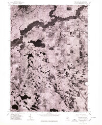
1976 Map of Twin Lake NW
USGS Topo · Published 1979About this map
The White River carves a dark, winding path through the northern landscape of this 1976 orthophotograph, providing a clear view of the dense vegetation and wetland corridors in Muskegon County. This aerial perspective, captured just before the decade's end, reveals a complex network of glacial kettle lakes and marshy terrain that characterizes the region. Further south, the settlement of Lakewood is visible near the shoreline of several small water bodies, while the significant expanse of Big Blue Lake dominates the central portion of the map. The imagery highlights the contrast between the heavily wooded river valley and the scattered clearings for residential development and agriculture, offering researchers a literal snapshot of land use and forest cover during the mid-1970s.
Find a feature on this map
3 named features on this map. Tap any name to fly to it.
Don’t see what you’re looking for? This feature index may not catch every label — zoom into the map to look around manually.
Map Details
Editions of this 1976 Twin Lake NW Map
This is the sole edition of this map. No revisions or reprints were ever made.
Other maps of this area

1929 · Montague
USGS Topo · 1:48,000

1931 · Hart SE
USGS Topo · 1:31,680

1931 · Walkerville SW
USGS Topo · 1:31,680

1931 · Walkerville SE
USGS Topo · 1:31,680

1954 · Milwaukee
USGS Topo · 1:250,000

1958 · Milwaukee
USGS Topo · 1:250,000

1958 · Hesperia
USGS Topo · 1:62,500

1958 · Twin Lake
USGS Topo · 1:62,500

1959 · Montague
USGS Topo · 1:62,500

1959 · Hart
USGS Topo · 1:62,500