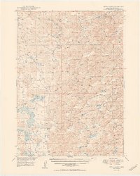
1950 Map of Twin Lakes
USGS Topo · Published 1950About this map
The Minnekaduza Valley and Survey Valley define the drainage patterns of this Sheridan County landscape, where the Sandhills ecology is punctuated by numerous groundwater-fed lakes. Scattered across the section lines of the mid-century Nebraska ranchlands, a network of one-room schoolhouses such as North Sch No 165, South Sch No 165, and School No 133 serve as the primary markers of settlement and community life. The hydrology of the region is centered on significant water bodies including Twin Lakes, Albrecht Lake, and Diamond Lake, which provided vital resources for livestock in an era of intensive grazing. Northward, the topography shifts toward the headwaters of Pine Creek and Deer Creek, near the localized landmark of Spring Lake Camp, illustrating the sparse but organized homesteading layout typical of the High Plains during the postwar period.
Find a feature on this map
18 named features on this map. Tap any name to fly to it.
Don’t see what you’re looking for? This feature index may not catch every label — zoom into the map to look around manually.
Map Details
Editions of this 1950 Twin Lakes Map
2 editions found
Other maps of this area

1948 · Bingham
USGS Topo · 1:62,500

1948 · Antioch
USGS Topo · 1:62,500

1948 · Lakeside
USGS Topo · 1:62,500

1948 · Twin Lakes
USGS Topo · 1:62,500

1948 · Spade Ranch
USGS Topo · 1:62,500

1949 · Antioch
USGS Topo · 1:62,500

1950 · Twin Lakes
USGS Topo · 1:62,500

1950 · Spade Ranch
USGS Topo · 1:62,500

1950 · Lakeside
USGS Topo · 1:62,500

1950 · Skunk Lake
USGS Topo · 1:62,500