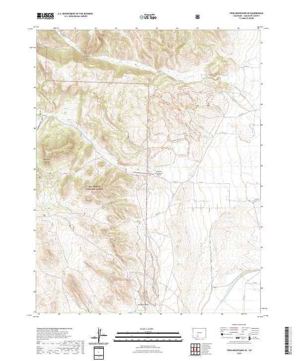
2022 Map of Twin Mountains SE
USGS Topo · Published 2022About this map
The eastern edges of the Rio Grande National Forest meet the valley floor in this modern survey of Saguache County. The landscape is defined by the sharp transition from the elevated peaks of Hellgate and Eagle Rock to the irrigation-dependent lands of the San Luis Valley, where the Rio Grande Canal and La Garita Cr provide critical water. Geologic features like Elephant Rocks and the winding Dollhand Ravine Trl highlight the complex erosion patterns common in the region.
Find a feature on this map
55 named features on this map. Tap any name to fly to it.
Don’t see what you’re looking for? This feature index may not catch every label — zoom into the map to look around manually.
Map Details
Editions of this 2022 Twin Mountains SE Map
This is the sole edition of this map. No revisions or reprints were ever made.
Other maps of this area

1915 · Del Norte
USGS Topo · 1:125,000

1917 · Del Norte
USGS Topo · 1:125,000

1945 · Durango
USGS Topo · 1:250,000

1953 · Durango
USGS Topo · 1:250,000

1954 · Durango
USGS Topo · 1:250,000

1961 · Durango
USGS Topo · 1:250,000

1963 · Durango
USGS Topo · 1:250,000

1964 · Sevenmile Plaza
USGS Topo · 1:24,000

1966 · Durango
USGS Topo · 1:250,000
1966 · Del Norte
USGS Topo · 1:24,000