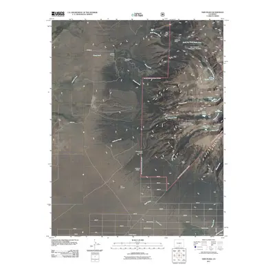
2011 Map of Twin Peaks
USGS Topo · Published 2011About this map
The Pioneer Urraca Cemetery and King Ranch anchor the lower elevations of this Colorado landscape, where the transition from high-altitude alpine basins to the valley floor is clearly defined. The terrain is marked by sharp topographic contrasts, from the waters of South Zapata Lake and Lake Como near the towering summits of Twin Peaks and California Peak, down to the engineered water management of the Garland Ditch. Evidence of early 21st-century mining interest remains at the Blanca Mine and Swab Mine, while the natural hydrology is dominated by drainage systems like Pioneer Creek and Urraca Creek. A rigid grid of residential streets, such as 24th St and 18th St, begins to push into the canyons, suggesting a pattern of modern development encroaching upon the natural features like Zapata Falls and Box Canyon.
Find a feature on this map
44 named features on this map. Tap any name to fly to it.
Don’t see what you’re looking for? This feature index may not catch every label — zoom into the map to look around manually.
Map Details
Editions of this 2011 Twin Peaks Map
This is the sole edition of this map. No revisions or reprints were ever made.
Other maps of this area

1889 · Huerfano Park
USGS Topo · 1:125,000

1892 · Huerfano Park
USGS Topo · 1:125,000

1954 · Trinidad
USGS Topo · 1:250,000

1955 · Trinidad
USGS Topo · 1:250,000

1958 · Trinidad
USGS Topo · 1:250,000

1959 · Trinidad
USGS Topo · 1:250,000

1965 · Medano Ranch
USGS Topo · 1:24,000

1965 · Blanca
USGS Topo · 1:24,000

1965 · Zapata Ranch
USGS Topo · 1:24,000

1965 · Baldy
USGS Topo · 1:24,000