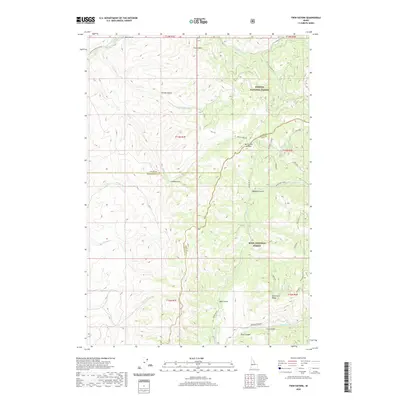
2020 Map of Twin Sisters
USGS Topo · Published 2020About this map
Twin Sisters stands as a prominent landmark at the intersection of the Payette National Forest and the Boise National Forest in this high-altitude region of Gem County. The landscape is defined by a dense network of drainages and ridges, where the Little Weiser River flows in the north and Squaw Creek cuts through the southern terrain. Key passage points like Mill Creek Summit and the winding Squaw Creek Rd indicate the historical importance of these mountain routes for forest access and resource management.
Find a feature on this map
35 named features on this map. Tap any name to fly to it.
Don’t see what you’re looking for? This feature index may not catch every label — zoom into the map to look around manually.
Map Details
Editions of this 2020 Twin Sisters Map
This is the sole edition of this map. No revisions or reprints were ever made.
Other maps of this area

1894 · Squaw Creek
USGS Topo · 1:125,000

1911 · Meadows
USGS Topo · 1:125,000

1953 · Smiths Ferry
USGS Topo · 1:62,500

1954 · Council
USGS Topo · 1:62,500

1954 · Cascade
USGS Topo · 1:62,500

1955 · Baker
USGS Topo · 1:250,000

1959 · Baker
USGS Topo · 1:250,000

1970 · Dodson Pass
USGS Topo · 1:24,000

1970 · Granger Butte
USGS Topo · 1:24,000
1970 · Riley Butte
USGS Topo · 1:24,000