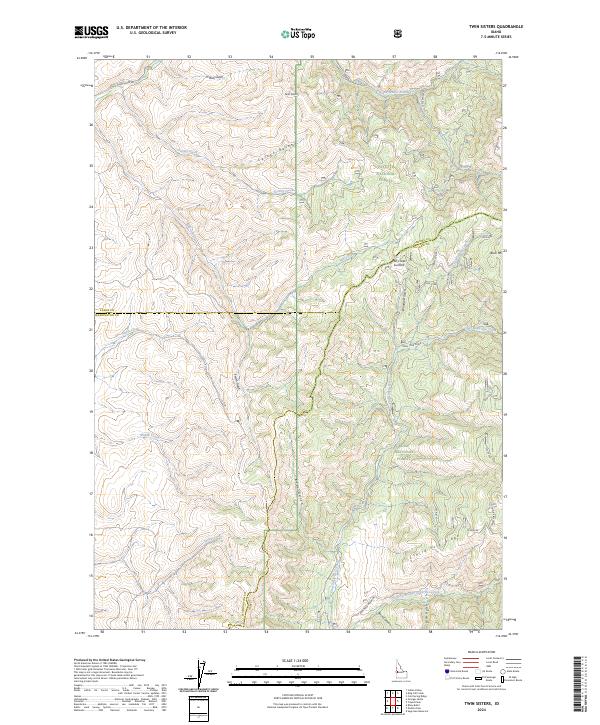
2024 Map of Twin Sisters
USGS Topo · Published 2024About this map
Twin Sisters and the surrounding high country define this rugged section of the Idaho landscape, where the administrative boundaries of Adams, Washington, and Gem counties converge. The terrain is a complex network of steep drainages and ridges, protected by the Payette National Forest and Boise National Forest. The Little Weiser River carves through the northern reaches, accessible via the Little Weiser River Rd, while internal drainage is managed by numerous named gulches and creeks, including Grizzly Creek and Carson Gulch. High points like Buck Mtn and the Mill Creek Summit provide significant local elevation, overseeing a wilderness landscape primarily shaped by natural topography rather than permanent settlements. This modern survey demonstrates the persistence of traditional land use and water management in the region, centered on features like Chief Eagle Eye Creek and the Third Fork Ridge.
Find a feature on this map
27 named features on this map. Tap any name to fly to it.
Don’t see what you’re looking for? This feature index may not catch every label — zoom into the map to look around manually.
Map Details
Editions of this 2024 Twin Sisters Map
This is the sole edition of this map. No revisions or reprints were ever made.
Other maps of this area

1894 · Squaw Creek
USGS Topo · 1:125,000

1911 · Meadows
USGS Topo · 1:125,000

1953 · Smiths Ferry
USGS Topo · 1:62,500

1954 · Council
USGS Topo · 1:62,500

1954 · Cascade
USGS Topo · 1:62,500

1955 · Baker
USGS Topo · 1:250,000

1959 · Baker
USGS Topo · 1:250,000

1970 · Dodson Pass
USGS Topo · 1:24,000

1970 · Granger Butte
USGS Topo · 1:24,000
1970 · Riley Butte
USGS Topo · 1:24,000