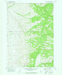
1970 Map of Twin Sisters
USGS Topo · Published 1974About this map
Twin Sisters stands as a prominent landmark at the intersection of several high mountain ridges within the southwestern Idaho backcountry. This 1970 field-checked survey documents a landscape defined by the transition between the Payette National Forest and the Boise National Forest. The topography is dominated by deep drainage systems, including the headwaters of the Weiser River and the Little Weiser River in the north, and the Third Fork Squaw Creek to the south. The transportation network of the era is almost exclusively composed of a Pack Trail and Jeep Trail system, highlighting the area's role as a remote timber and grazing resource. Notable geographic points like Mill Creek Summit and Woodard Ridge provided critical navigational markers for forest rangers and travelers crossing the tri-county boundary of Adams, Gem, and Washington counties.
Find a feature on this map
26 named features on this map. Tap any name to fly to it.
Don’t see what you’re looking for? This feature index may not catch every label — zoom into the map to look around manually.
Map Details
Editions of this 1970 Twin Sisters Map
This is the sole edition of this map. No revisions or reprints were ever made.
Other maps of this area

1894 · Squaw Creek
USGS Topo · 1:125,000

1911 · Meadows
USGS Topo · 1:125,000

1953 · Smiths Ferry
USGS Topo · 1:62,500

1954 · Council
USGS Topo · 1:62,500

1954 · Cascade
USGS Topo · 1:62,500

1955 · Baker
USGS Topo · 1:250,000

1959 · Baker
USGS Topo · 1:250,000

1970 · Dodson Pass
USGS Topo · 1:24,000

1970 · Granger Butte
USGS Topo · 1:24,000
1970 · Riley Butte
USGS Topo · 1:24,000