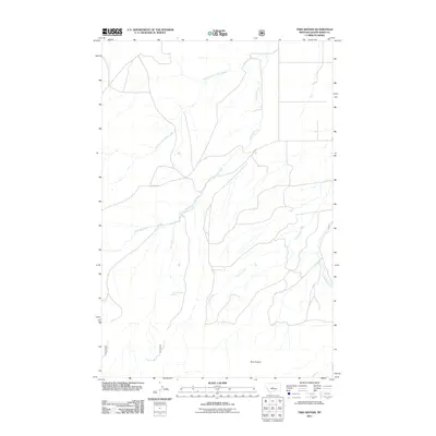
2011 Map of Twin Sisters
USGS Topo · Published 2011About this map
The Twin Sisters landmarks rise above a network of high-plains drainages in this 2011 survey of Judith Basin County. The landscape is primarily defined by the branching tributaries of Antelope Creek, including the West Fork Antelope Creek and East Antelope Creek, which cut through the open terrain of central Montana. This digital-age topographic study provides precise locations for specific water sources such as 12N13E22AB_02 Spring and 12N13E21DB_01 Spring. The eastern portion of the map shows the headwaters of Coyote Creek and West Buffalo Creek, illustrating the complex watershed patterns in a region where seasonal and spring-fed water remains critical for land use and ranching. The road network is sparse, consisting mostly of local routes that follow the natural contours of the stream valleys.
Find a feature on this map
8 named features on this map. Tap any name to fly to it.
Don’t see what you’re looking for? This feature index may not catch every label — zoom into the map to look around manually.
Map Details
Editions of this 2011 Twin Sisters Map
This is the sole edition of this map. No revisions or reprints were ever made.
Other maps of this area

1886 · Little Belt Mts.
USGS Topo · 1:250,000

1889 · Big Snowy Mountain
USGS Topo · 1:250,000

1893 · Big Snowy Mountain
USGS Topo · 1:250,000

1894 · Little Belt Mts.
USGS Topo · 1:250,000

1897 · Little Belt Mts.
USGS Topo · 1:250,000

1898 · Little Belt Mts.
USGS Topo · 1:250,000

1902 · Little Belt Mts.
USGS Topo · 1:250,000

1948 · White Sulphur Springs
USGS Topo · 1:250,000

1954 · Roundup
USGS Topo · 1:250,000

1958 · Roundup
USGS Topo · 1:250,000