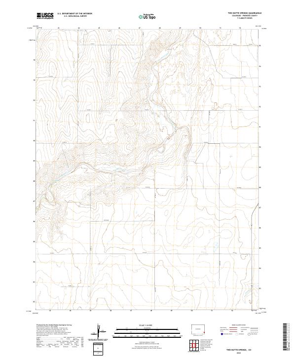
2022 Map of Two Butte Springs
USGS Topo · Published 2022About this map
Two Butte Springs and the winding course of Two Butte Creek define this rural landscape in southeastern Colorado. Located in Prowers County, the area is characterized by a strict grid of county roads, including Co RD 31, Co RD 29, and Co RD 34, which divide the terrain into township and range sections such as t25s r43w and t26s r42w. The drainage patterns of Plum Cr in the northwest and Dry Cr in the southeast provide essential water sources in this high plains environment. While largely undeveloped, the presence of Rice Blvd and an organized network of local connectors suggests a landscape managed for agricultural or ranching utility in the modern era.
Find a feature on this map
24 named features on this map. Tap any name to fly to it.
Don’t see what you’re looking for? This feature index may not catch every label — zoom into the map to look around manually.
Map Details
Editions of this 2022 Two Butte Springs Map
This is the sole edition of this map. No revisions or reprints were ever made.
Other maps of this area

1891 · Albany
USGS Topo · 1:125,000

1893 · Albany
USGS Topo · 1:125,000

1955 · La Junta
USGS Topo · 1:250,000

1958 · La Junta
USGS Topo · 1:250,000
1966 · Durkee Creek NE
USGS Topo · 1:24,000
1966 · Two Butte Springs
USGS Topo · 1:24,000
1966 · Durkee Creek NW
USGS Topo · 1:24,000
1966 · Durkee Creek SE
USGS Topo · 1:24,000

1968 · La Junta
USGS Topo · 1:250,000
1968 · North Plum Creek NE
USGS Topo · 1:24,000