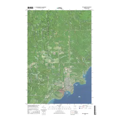
2016 Map of Two Harbors
USGS Topo · Published 2016About this map
The Lake Superior coastline at Two Harbors serves as the focal point for this 2016 survey, where the town's industrial and maritime layout meets the rugged northern shore. The harbor is clearly defined by Agate Bay and Burlington Bay, protected landings that historically supported the regional iron ore trade. Moving inland, the map captures a transition from the urban grid of Two Harbors to the smaller rural settlements of Waldo and Stewart. Genealogists and local historians can locate specific sites such as Lakeview Cem and Holy Spirit Catholic Cem, which provide clues to the community’s heritage and growth over the decades. The landscape is deeply carved by water, with the Stewart River, Little Stewart River, and Skunk Cr draining toward the lake. Prominent landmarks like Pork City Hill and the Richard B Helgeson Airport mark the higher ground, illustrating how the region's topography has influenced modern transportation and settlement patterns along the North Shore.
Find a feature on this map
100 named features on this map. Tap any name to fly to it.
Don’t see what you’re looking for? This feature index may not catch every label — zoom into the map to look around manually.
Map Details
Editions of this 2016 Two Harbors Map
This is the sole edition of this map. No revisions or reprints were ever made.
Other maps of this area

1953 · Knife River
USGS Topo · 1:24,000

1953 · Ashland
USGS Topo · 1:250,000

1954 · Mc Carthy Creek
USGS Topo · 1:24,000

1954 · Two Harbors
USGS Topo · 1:250,000

1956 · King Lake
USGS Topo · 1:24,000

1957 · Two Harbors
USGS Topo · 1:250,000

1957 · Two Harbors
USGS Topo · 1:62,500

1957 · Two Harbors
USGS Topo · 1:24,000

1957 · Two Harbors NE
USGS Topo · 1:24,000

1957 · Castle Danger
USGS Topo · 1:24,000