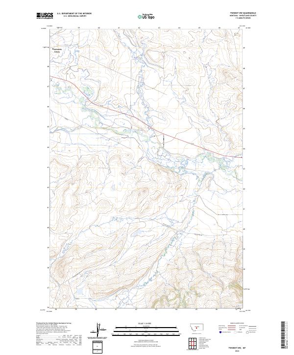
2024 Map of Twodot NW
USGS Topo · Published 2024About this map
Martinsdale Colony sits at the northwestern edge of this Wheatland County landscape, where the Musselshell River meanders across the central terrain. The map documents a sophisticated water management network essential to this region of Montana, featuring the Twodot Canal and numerous named tributaries like Daisy Dean Creek and Little Elk Creek. The land is defined by a grid of townships and ranges, including t8n r12e and t9n r13e, which organize the high plains and coulees. Transportation is primarily limited to rural routes such as Miller Creek Rd, which traces the path of Miller Creek through the southern sections. This survey provides a clear view of the ranching and agricultural infrastructure, including the distinct terrain of Willis Coulee in the northeast.
Find a feature on this map
15 named features on this map. Tap any name to fly to it.
Don’t see what you’re looking for? This feature index may not catch every label — zoom into the map to look around manually.
Map Details
Editions of this 2024 Twodot NW Map
This is the sole edition of this map. No revisions or reprints were ever made.
Other maps of this area

1886 · Little Belt Mts.
USGS Topo · 1:250,000

1894 · Little Belt Mts.
USGS Topo · 1:250,000

1897 · Little Belt Mts.
USGS Topo · 1:250,000

1898 · Little Belt Mts.
USGS Topo · 1:250,000

1902 · Little Belt Mts.
USGS Topo · 1:250,000

1948 · White Sulphur Springs
USGS Topo · 1:250,000

1958 · White Sulphur Springs
USGS Topo · 1:250,000

1961 · White Sulphur Springs
USGS Topo · 1:250,000

1965 · White Sulphur Springs
USGS Topo · 1:250,000
1972 · Lebo Lake
USGS Topo · 1:24,000