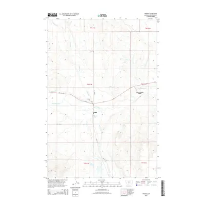
2014 Map of Twodot
USGS Topo · Published 2014About this map
Twodot and the Duncan Ranch Colony occupy a landscape defined by the drainage of the Musselshell River and its numerous tributaries. This ranching and agricultural region in Wheatland County relies on an intricate network of water management, visible through features like the Twodot Canal and the southern Fox Reservoir. The terrain is marked by distinctive elevations such as Suicide Hill, while the local cemetery, Twodot Cem, provides a point of interest for those researching the genealogy of this central Montana community. Several seasonal creeks, including Haymaker Cr, Alkali Cr, and Big Elk Cr, cross the township lines, illustrating the natural irrigation patterns that support the local ranching economy. Transportation is anchored by Us-12 and the Two Dot Hwy, which connect these small settlements across the high plains.
Find a feature on this map
21 named features on this map. Tap any name to fly to it.
Don’t see what you’re looking for? This feature index may not catch every label — zoom into the map to look around manually.
Map Details
Editions of this 2014 Twodot Map
This is the sole edition of this map. No revisions or reprints were ever made.
Other maps of this area

1886 · Little Belt Mts.
USGS Topo · 1:250,000

1889 · Big Snowy Mountain
USGS Topo · 1:250,000

1893 · Big Snowy Mountain
USGS Topo · 1:250,000

1894 · Little Belt Mts.
USGS Topo · 1:250,000

1897 · Little Belt Mts.
USGS Topo · 1:250,000

1898 · Little Belt Mts.
USGS Topo · 1:250,000

1902 · Little Belt Mts.
USGS Topo · 1:250,000

1948 · White Sulphur Springs
USGS Topo · 1:250,000

1954 · Roundup
USGS Topo · 1:250,000

1958 · Roundup
USGS Topo · 1:250,000