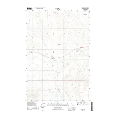
2017 Map of Twodot
USGS Topo · Published 2017About this map
The settlement of Twodot serves as the focal point of this Montana landscape, situated along the banks of the Musselshell River in Wheatland County. The local geography is defined by a network of waterways and ranch roads, including Haymaker Cr and Alkali Cr which feed into the primary river valley. Notable landmarks such as Suicide Hill and the Twodot Cem overlook the valley floor, providing a sense of the local topography and historical footprint of the community. In the southern portion of the area, the Fox Reservoir and the course of Big Elk Cr reflect the importance of water management in this prairie environment. The presence of the Po and the Twodot Canal further illustrates the established infrastructure supporting the residents of this rural ranching district during the early 21st century.
Find a feature on this map
21 named features on this map. Tap any name to fly to it.
Don’t see what you’re looking for? This feature index may not catch every label — zoom into the map to look around manually.
Map Details
Editions of this 2017 Twodot Map
This is the sole edition of this map. No revisions or reprints were ever made.
Other maps of this area

1886 · Little Belt Mts.
USGS Topo · 1:250,000

1889 · Big Snowy Mountain
USGS Topo · 1:250,000

1893 · Big Snowy Mountain
USGS Topo · 1:250,000

1894 · Little Belt Mts.
USGS Topo · 1:250,000

1897 · Little Belt Mts.
USGS Topo · 1:250,000

1898 · Little Belt Mts.
USGS Topo · 1:250,000

1902 · Little Belt Mts.
USGS Topo · 1:250,000

1948 · White Sulphur Springs
USGS Topo · 1:250,000

1954 · Roundup
USGS Topo · 1:250,000

1958 · Roundup
USGS Topo · 1:250,000